[Sagri] Farmland Visualization solutions by Sagri Satellite, AI/ML and GRID.
We are working to solve the food and environmental problems facing humanity by utilizing grid-like surface data viewed from space, satellite data, and big data obtained from the ground. We present solutions to social issues by combining soil analysis, machine learning, image recognition, and other technologies.
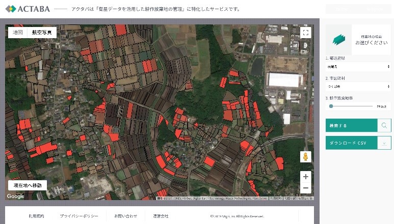
Detection and Monitoring System for Abandoned Land Using Satellite Data: ACTABA
The degree of abandoned farmland is expressed by polygonal shading by combining satellite data and agricultural data. Visualization of farmland information and detection of abandoned farmland is now possible from the web. The system will facilitate the monitoring of abandoned farmland, which until now has been conducted visually.
The degree of abandoned farmland is expressed by polygonal shading by combining satellite data and agricultural data. Visualization of farmland information and detection of abandoned farmland is now possible from the web. The system will facilitate the monitoring of abandoned farmland, which until now has been conducted visually.
In India, ACTABA is promoting a demonstration experiment for wheat yield forecasting and protein content improvement by crossing agricultural big data and satellite data. In addition, applying the know-how of ACTABA mentioned above, the company is developing DX (Digital Transformation) for the purpose of "visualization of agricultural land" for agricultural professionals.